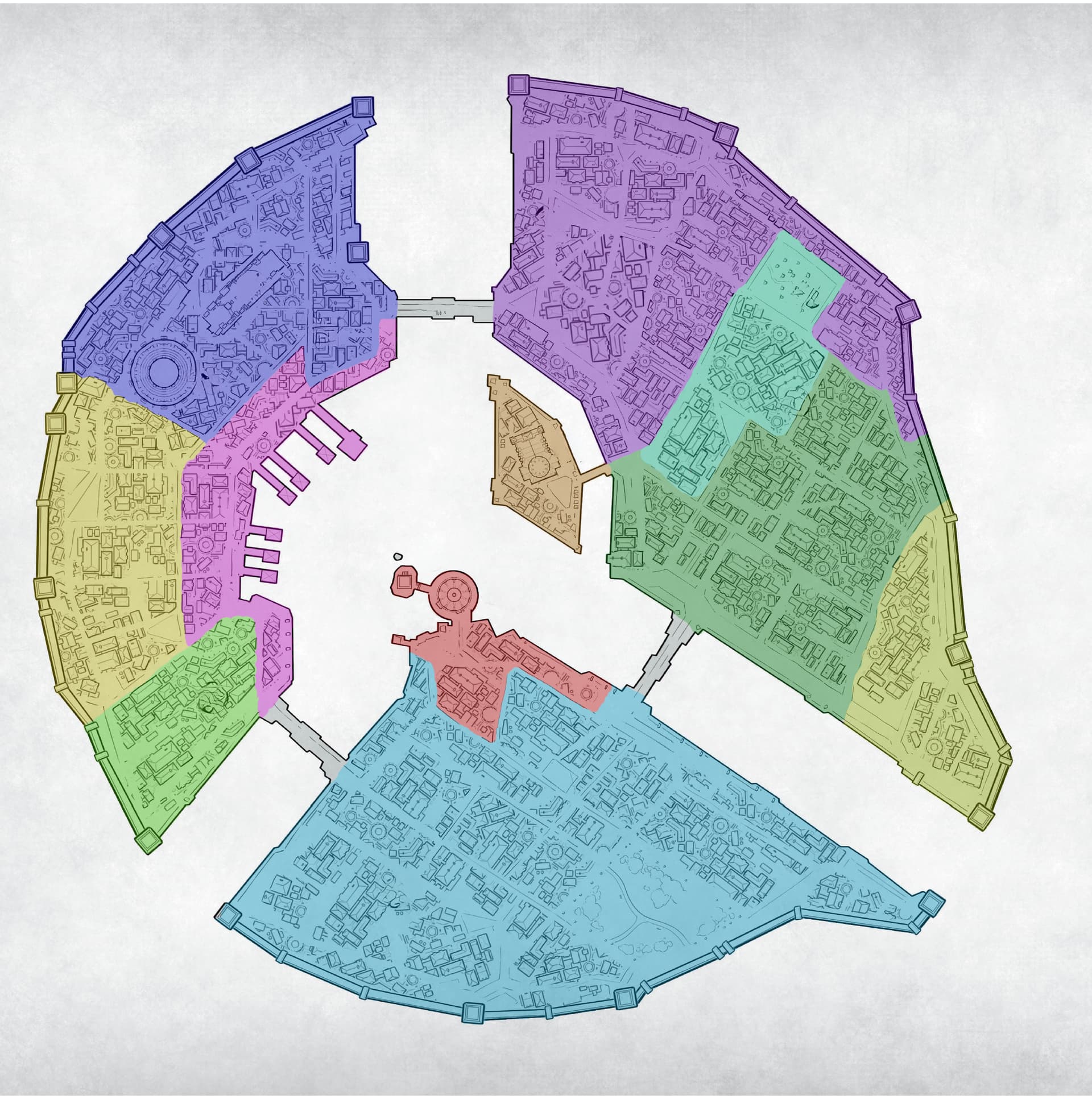
So I took some liberties with the naming of the districts drawing from the Requiem GMs kit, The og Wichfire trilogy and KNG. As for their areas I sort did what felt right. There were a few discrepancies between the various books so I just made it work. Others might disagree with where these things are place or even what/how many districts there are and that is totally valid.
Light blue - South district, where the affluent call home also Corvis University
Red - Government District, has City hall and Court/Jail house. I made this a whole district because I like the idea of during the previous wars they would have expanded to meet the needs of all the refugees. As of the time of requiem a lot of these buildings stand empty now.
Light green - Armorer’s Bourg
Magenta - Waterfront District
West District - more run down, home of the menite temple
Dark Blue - Merchants Bourg, has the colosseum and the Quad
Purple - Industrial Bourg
Teal- Military District, The old Orgoth admin building as well as the northern graveyard. This is the primary station for the Cygnaran military in Corvis. Barracks, munitions depos, warjack repair facilities, that kind of thing
Green - Eastern district more of the working class area, the quiet part of town for those just working and living
Yellow - Grocers Bourg, the stomach of the city. Food from the surrounding area comes here as well as store houses for food.